This is a complete one year course, comprised of two semesters. The first session deals with the theoretical framework of Remote Sensing, GIS and GPS. Later on, the empirical tasks to be performed here involves earth feature identification and representation. Next the second semester proceeds with computer programming and cartographic techniques. This session provides the knowledge on disaster risk management through geo-spatial techniques. Moreover, the following session includes preparation of projects which will help the learners in refining the geo-based techniques.
Syllabus
Paper 1 : Fundamentals of Remote Sensing and Photogrammetry
Unit 1 : Introduction to Remote Sensing
- Concept: Definition, History of development, Process and elements of Remote Sensing, Advantages and limitations
- Concept of EMR: Wavelength, Frequency & Energy relation of EMR, EMR Spectrum, Wavelength region wise application, Atmospheric window, EMR interaction with atmosphere and earth surface, Fundamentals theories and Law of EMR (Radiation laws, Stefan Boltzman law, Wien’s law, Kirchoff’s law, Concept of Blackbody)
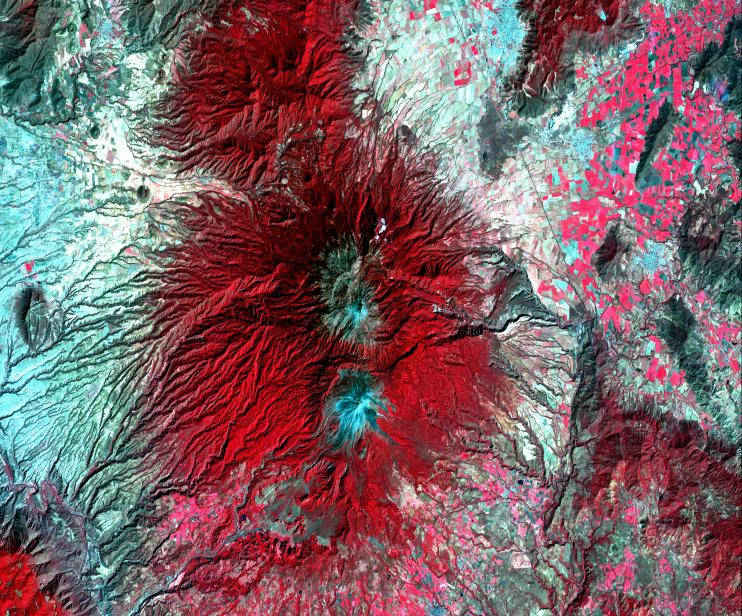
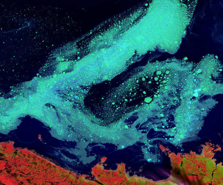
- Platforms, Sensors, Satellite & Resolution: Introduction and different types of Platform (Ground, Airborne and Spaceborn), Sensor (imagine & non-imagine; Active & Passive; Whiskbroom & Push broom), Satellite (Polar Orbital & Geostationary) and Resolution (Spatial, Spectral, Radiometric, Temporal)
- Spectral signatures: Signature of soil, vegetation and water
Unit 2 : Introduction to Photogrammetry
- Aerial Photography: Concept, History of development, Advantages and limitations, Types, Difference between maps and Aerial photography, Controlling parameters, types of camera, Displacement (Image displacement, Relief displacement, Radial displacement)
- Geometry of Aerial Photograph: Determination of scale (Small and Large scale), Determination of height on aerial photograph, Stereoscopic Vision, Photographic overlay, Height determination from Stereo pair
- Co-ordinate system: Relief distortion and Tilt distortion, , Digital Elevation, Model
- Principal of digital Photogrammetry: Hardware & Software requirement, Image measurement, Digital Terrain Model (DTM)
Paper2 : Fundamentals of GIS and GPS
Unit 1: Introduction to GIS
- Basic Concept: Definition, History, Components of GIS, GIS application, Advantages and limitations, GIS software packages
- GIS Data: Spatial and Non spatial data, Data structure – Raster & Vector data structure, Vector data: Representation of geographic data in vector, Arc, Nodes, Vertices and topology, Data file
- GIS database: Database creation & design, Database management, Introduction to DBMS & RDBMS, SQL operations, Manipulating dataset using SQL statement, Advantages of RDBMS, Restricting and sorting data (Using Cooperation condition), Logical operator: AND, OR, NOT, XOR, using BETWEEN, LIKE conditions
- GIS data input: Nature of data, Methods of spatial data capture (Digitization and Scanning method), Rectification, Error identification, Reprojection, Transformation and Generalization
Unit 3 : Introduction to GPS
- Basic Concept: Definition, Development, Components of GPS, Types, GPS application, Advantages and limitations, Satellite constellation, GPS signals and data, NAVSTAR, GLONASS, IRNSS
- GPS surveying methods and accuracy: Static & Rapid static, Kinematic –Real time kinematic survey, Pseudo kinematic survey Factors affecting GPS accuracy, GPS application in surveying and mapping
Unit 1 : Introduction to Cartography & Digital Cartography
- Digital Cartography: Concept, Advantages and limitations
- Map Scale: Definition, Projection system, Categories of maps & map scales
- Measurement of geographical variables: Nominal, Ordinal, Interval and Ratio scale Qualitative & Quantitative data
- Digital Mapping: Design issues, Concept of visual variables, Map lattering, Map compilation, Generalization, Map composition, Multivariate and dynamic mapping, map production
- Visualization of geospatial data – 2D & 3D Visualization
Unit 2 : Application of Geoinformatics in Earth Science
- Geography as a discipline, Nature and scope
- The Earth System: Concepts & Elements of Earth System, Structural Feature of the Earth
- Concept of Geomorphology: Fundamental of Geomorphology, Geomorphic agent and process, Drainage system & its pattern, Classification of Landforms : Fluvial, Aeolian, Glacial and Marine, Rock types, Rock structure (Folds, Faults and Lineament)
- Applications of Remote sensing in Geographical & Geological (Lithological and structural mapping), Multivariate data modeling application in Geosciences application
Paper 4 : Concepts of Geo statistical techniques and spatial decision support system
Unit 1 : Concepts of Geo statistical techniques
- Grouped data and Ungrouped data, Concept of correlation
- Correlation analysis scatter diagram, Root Mean Square Error
- Surface modeling: Role of interpolation, Methods of interpolation, Inverse Distance Interpolation, Interpolation by Kriging, Digital Elevation Model (DEM), TIN (Triangulated Irregular Network)
- Organization of Data: Frequency, Class intervals, Histogram and distribution, Presentation of data – Tables, Diagrams
Unit 2 : Concept of spatial decision support system
- SDSS: Concept, Characteristics, applications
- Multi-criteria decision Analysis (MCDA): Elements, Structure of MCDA Multi-criteria Decision Analysis
- Concept of Spatial Multi-criteria Decision Analysis
- Concept of Weighting
Paper 5 : Digital image processing technique
Unit 1 : Introduction to Digital image processing technique
- Introduction: Concept, Source of data, Data format, Hardware and software requirement in digital image processing, Data loading
- Image processing: Sources of errors, Image rectification, Resampling techniques, Radiometric correction, Geometric correction, Contrast stretching – Linear and Non Linear
- Spatial texture manipulation: Spatial filtering, Edge enhancement techniques and Fourier analysis
- Multi Image manipulation: Band rationing and differencing, Principal Component Analysis, Image Fusion, Band Correlation, Statistical evaluation of image Quality Parameters
Unit 2 : Information Extraction from satellite imageries
- Elements of Image Interpretation & Interpretation Keys: Visual & Digital Image Interpretation
- Ground truthing, Spectral signature, Interpretation of target properties, Spatial pattern recognition, Spectral pattern recognition, Parametric and Non parametric classifier, Advantages and disadvantages of different classifies
- Classifier Techniques: Unsupervised (Isodata, K-mean) and Supervised classification (Minimum distance to mean, Parallelepiped, Maximum Likelihood)
- Accuracy assessment: Reference data, sampling techniques, Error matrix, Kappa statistics
- Change detection analysis
- Artificial Neural Network (ANN), Fuzzy Classifiers
Practical Paper: (Lab based work)
Unit 1 : Fundamentals of Remote Sensing and Photogrammetry
- Geo-referencing of Toposheets & Imagery
- File export import, Conversion of file formats
- Image registration / Geo coding, Projection, Creating Region of Interest
- File sub setting / clipping Mosaic Air photo and Images
- Feature identification and signature curve generation, Image Statistics & Histogram
- Identification of different features using TM, FCC & Thermal Imagery
- Interpretation of Satellite Imagery in Different Bands
- Scale measurement of aerial photographs, Distance and area measurement of themes
- Aerial-photo Interpretation for Terrain Evaluation and thematic mapping
- Stereo plotting with photogrammetric Instruments
Unit 2 : Fundamentals of GIS and GPS
- Digital database creation: Point, Line, Polygon
- Conversion of Raster, Vector and Others
- Managing Geo-database, geometric measurements tools & Changing Projection
- Managing attribute table and thematic mapping
- Map composition and representation
- Relational Database Query
- Logical operator: AND, OR, NOT, XOR, using BETWEEN, LIKE conditions
- Attribute Data Input: Creation of Schema, Tables, Data Definition
- Data Input, Data Updating, Queries on Tables, Simple-Complex Query with Two or More Tables Using SQL, Queries Using Union, Intersection
- Join Etc Operations. Use of MS-Excel and MS Access
- Introduction to a GPS and initial setting
- Creating codes and attribute table for GPS receiver, Point Data collection using GPS with different datum, Line data collection using GPS and measurements, GPS data collection for area calculation
- Post processing of the GPS data, GPS and GIS integrations output preparation
Unit 3 : Fundamentals of Cartography and application of Geoinformatics in Earth Science
- Construction of different types of scales (Simple, Comparative & Diagonal)
- Construction of Map Projection (Conical, Cylindrical, Zenithal Projection)
- Designing, Symbolization, Pattern and Shading techniques
- Identification of geographical feature (Lithological, Lineament, geological, Drainage pattern)
- Surface Modelling: Analysis using DEM & TIN
Unit 4 : Concepts of Geo statistical techniques and spatial decision support system
- Introduction of Statistical Software: Time series, Charts, Scatter plot with regression line, Histogram, Correlation, Neighbourhood analysis
- Principal Component analysis, Spatial autocorrelation
- Interpolation techniques: IDW and Krigging through GIS softwares
- Extraction of image statistics
- Regression model
- Multi-criteria decision Analysis
Unit 5 : Digital image processing technique and information Extraction from satellite imageries
- Image Processing System: Loading of Image Data, Identification of Objects on Visual Display, Study of Histograms and Layer Information
- Image Enhancement Techniques: Linear and Non- Linear Contrast, Enhancement, Band Rationing, Edge Enhancement, High and Low Pass, Filtering
- Atmospheric Correction & Geometric correction
- Image Classification: Classification : Supervised, Unsupervised and Use of Different Algorithms, Change Detection
- Accuracy Analysis: Producer, User Accuracy, Overall and Mapping, Accuracy, Kappa Coefficient, Confusion matrix
- Presentation: Map Composition
- Editing and Topology
- Building, Area and Perimeter Estimation
Semester II :
Theory :
Paper 1 : Advance concepts in Remote sensing and GIS techniques
Unit 1 : Advance Remote Sensing techniques
- Thermal Remote Sensing: Basic Principles, Physical Laws, Blackbodies and Emissivity, Thermal Infrared Radiation Properties, Thermal Infrared Atmospheric Windows, Interaction of Thermal Radiation with Terrain Elements,
- Thermal Data Processing: Thermal Energy Detectors, Thermal Radiometers, Thermal Scanners, Interpreting Thermal Scanner imaginary, Applications
- Microwave Remote Sensing: Basic Principles, Radar Operation, Polarization, Spatial Resolution, Radar Image Geometry, Relief Displacement, Shadows and Speckle effect, Side Looking Radar System (SLAR) Operation, Synthetic Aperture Radar (SAR), Radar Interferometry
- RADAR Environmental Considerations: Surface Roughness Characteristics, Electrical Characteristics, Vegetation and Water response to Microwave energy, Microwave Remote Sensing and its advantages, Active and Passive Microwave Systems, Applications
Unit 2 :Advance techniques in GIS platform
- Data Storage: Vector and Raster data model, Digital coding and storing of Point, Line and Polygon, Spaghetti Model, Topological Model, Quadtree, Conversion between Raster and Vector
- Database Modeling: Hierarchical Model, Network Model, Relational Model
- Data Organization: Chain Coding, Run-length Coding, Block Coding
- Spatial Analysis: Types of Spatial Analysis, Measurement in GIS, Query – Query by Attributes, Spatial Queries, Attribute Based Operation, Neighborhood Analysis, Connectivity Analysis, Overlay and Coverage Rebuilding
- Data Quality and Errors in GIS: Errors and Uncertainty in GIS data, Positional and Attribute Accuracy
- Web GIS, Mobile GIS
Unit 3 : Concept of GEODESY
- Geoids: Concept of Spherical Geometry and Geodesy, Reference Spheroid and Mean Sea Level
- Introduction to different spheroid / ellipsoid systems with special reference to Everest and WGS-84 - Geometric Constants, Indian Geodetic Datum; Rectangular and Geographical Co-ordinate System
- Satellite Geodesy: Early satellites, Interferometry, Doppler, Point Positioning, Translocation, Observational systems, New Satellite gravity missions
Paper 2 : Geospatial analysis and applications
Geospatial analysis and applications
- Introduction to Spatial Analysis: Significance of Spatial Analysis
- Vector Based: Overlay Operations: Point-In-Polygon, Line-In-Polygon, Polygon-In-Polygon. Single Layer Operations: Feature Identification, Extraction, Classification Manipulation. Multilayer Operation: Union, Intersection, Symmetrical Difference, Update, Merge, Append and Dissolve
- Raster Based: Map Algebra, Grid Based Operations, Local, Focal, Zonal and Global Functions, Cost Surface Analysis and Proximity analysis
- Network Analysis: Concepts, Evaluation of Network Complexity Using Alpha-Gamma Indices, Network Data Model. Path Analysis
- Point Pattern Analysis: Methods for Evaluating Point Patterns: Clustered and Random Distribution
- Spatial Modelling: Role of Spatial Model, Explanative, Predictive and Normative Models. Correlation-Regression Analysis in Model Building
- Introduction to Spatial Analysis using ‘R’
Paper 3 : Computer Programming
Unit 1 : Fundamentals of Computer
- Introduction to Computers, Data representation, Conversion of data. Memory organization, Different secondary storage devices
- Data Representation: Representation of Characters in Computers, Representation of Integers, Representation of Fractions, Hexadecimal Representation of Numbers, Decimal to Binary Conversion
Unit 2 : Data Communication
- Introduction to Networks, Star and Bus LAN topologies, Central and distributed computing, Wide area and global networks, The World Wide Web; Using the Internet and email effectively
Unit 3 : C Programming
- Introduction to Programming: Basic concepts, program constructions (flowcharts, algorithms, pseudo codes, data structures – stacks, queues, linked lists etc.), Approaches to programming – Top-down, Bottom-up approach, divide & conquer, modular programming
- C programming: Preliminaries, Constants & Variables, Arithmetic Expressions, Input Output statements, Control Statements, Do-Statements, C-Preprocessor, Do-While statement, if-else statement, Array, Pointer. Elementary Format Specifications, Logical Statements & Decision Tables
- Data Arrangement and access: Basic of Data Arrangement and access, file Environment, Relational database system, DBMS
Unit 4 : Introduction to Python
- Introduction to Python, Python vs. .NET Vs. JAVA
- Data Type Operators: Data Types, Basic Sample Programming Control Flow, Arrays, List and strings. Classes Modules: Creating Modules and Classes, GIS data access and manipulation with python
Paper 4 : Elective Paper
Optional Paper 1: Geoinformatics in Disaster Management
Unit 1 : Introduction to Disaster Management
- Hazard & Disaster: Their types & characterization
- Concept of Disaster Management: Pre Disaster, Post Disaster
- Hazard & Disaster Mitigation: Landslides, flood, earthquake, Cyclone etc
- Disaster Management: Government, NGOs and peoples participation disaster management. Existing organization structure for managing disasters in India.
Unit 2 : Applications of Disaster Management & Mitigation
- Uses of Geoinformatics in Disaster Mitigation
- Image Interpretation and Analysis for Natural Hazards Assessment
- Application of Geoinformatics to Environmental Hazards Monitoring and Modeling
- Application of Geoinformatics to Geological Hazards Modeling and Analysis
- Application of Geoinformatics to Hydrological Hazards Modeling and Analysis
Optional Paper 2: Geoinformatics in Urban, rural development & regional planning
Unit 1 : Introduction to Urban and Rural planning and Development
- Concepts: Introduction to urbanization and urbanism, Origin & growth of urban settlements; process of urbanisation
- Urbanization in India: a historical perspective
- Theoretical framework of rural development: Introduction to Rural development, Factors, Rural economy, experiences of developed and developing world with examples
- Growth Pole theories and the developing world, Regional Environmental Issues
Unit 2 : Applications of Geoinformatics in Urban, rural development & regional planning
- Analysis of rural settlement: Cause and effect, distribution of rural settlement with special reference to size and spacing
- Rural service centres, Studies on rural urban continum
- Brief introduction of Remote Sensing applications on urban landscape, Population estimates, housing quality studies, site selection processes, traffic and parking studies, Urban & rural change detection studies
- Applications of RS techniques in Environmental impact assessment in Regional planning
Unit 3 : Case Study
Paper 4 : Project
In the beginning of the Second Semester each learner will choose a topic to continue their project report. The research topic will be guided by their respective supervisors specified by the learner. Each of the learner can proceed their work on individual basis or team work (maximum 2). The work continues with identification of the issues, previous literature work, collection of manifold data (primary and secondary), laboratory investigations, analysis and results achieved etc., under the supervision of their specific guidance. As the work arrives in the last stage the learners are required to submit one copy to the institution in the form of full pledged Project report. On precisely completion of the project, each learner required to portray his/her thesis through power point presentation in front of an expert, faculty and other learners. This presentation will be followed by Viva-voce.
These essential works fortify the techniques and skills gained in the inputs of the course, moreover this research will provide learners develop their thinking as well as to build their talents to serve practically in real world.
- Topics to be covered
- Problem identification, literature review, Data acquisition & collection, Field work, Data processing (Database & Methodology), Results and Discussion/analysis, Report writing and presentation
Practical Paper: (Lab based work)
Unit 1 : Advance concepts in Remote sensing and GIS techniques
- Geometric and Atmospheric Correction
- Image enhancement and filtering
- Advanced classification techniques
- Accuracy assessment, ground truthing with spectro-radiometer Algorithm Liberation, Raster calculation, modelling
- Vector Editing, Data base creation, Managing Attribute Table, Thematic Maps Charts and Diagrams generation Select and Query in vector layers, GIS based models.
- Network, Neighbourhood, Buffer, Proximity, Overlay, Intersection, & Union
- Topographic & Morphometric analysis: TIN, DEM, Contour & Isopleth generation
Unit 2 : Geospatial analysis and applications
- Editing Data: Selecting Features, Simple Editing Functions, Creating New Features, Modifying, Schema Changes
- Understanding Tables, Field Types, Table Manipulations, Table Relationship, Joins, Relates, Creation of Graphs and Reports
- Network Analysis: Network Utility, Creating Network Model, Shortest Path, Geocoding
Unit 3 : Computer programming
- C Programming Language: Basics, Statements, Loop, Array, String, Pointer vi. DBMS: Database Generation, Database Management, Quarry in Oracle
- Python Programming: Flow, Arrays, List and strings. Classes Modules: Creating Modules and Classes, GIS data access and manipulation with python
Unit 4 : Elective Paper
- Geoinformatics in Disaster Management
- Geoinformatics in Urban, rural development & regional planning